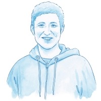
Ian Church,
Marine Mapping Specialist
Ian Church is an Assistant Professor at the University of New Brunswick (UNB) in Fredericton, New Brunswick. He leads UNB’s Ocean Mapping Group. He uses multibeam sonar to create detailed maps of the seafloor. He teaches students about ocean mapping
Dive DeeperMarine Career Interview
What do you do?
I’m an Assistant Professor at the University of New Brunswick in Fredericton. I work in the Department of Geodesy and Geomatics Engineering. I specialize in teaching and research on the topic of mapping the ocean floor using sonar.
Why is mapping the seabed important?
Mapping the seafloor is extremely important because the ocean floor is the last unexplored frontier on earth. Around 70% of the earth’s surface is underwater, and we have mapped only about 20% of our oceans to modern standards. That leaves a big part of the world waiting to be fully explored.
Why is so little of the seabed mapped?
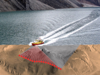
If you stand next to the ocean, or even a lake or river, you can’t see the bottom through the water. This is because light doesn’t travel very well through water. So in order to get a map or “picture” of the ocean floor, we can’t use any technology that uses light to take that picture. For example, Google Maps uses satellite images that rely on sunlight reflecting off the ground. In the ocean, this light reflects off the surface of the water or doesn’t penetrate much below the surface. We need a different technology to see below the surface of the water. That’s why we use sound in the form of sonar.

A multibeam sonar map of the reversing falls in the Saint John River. (Photo: University of New Brunswick)
What does your typical day involve?
My typical day involves working with sonar data from ships, trying to better understand the underwater world around us. I also write about my research findings and teach classes related to mapping the ocean floor.
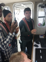
Ian teaching students aboard the CHM Heron survey vessel. (Photo: University of New Brunswick)
What do you enjoy most about your job?
There are three things I enjoy most about my job. One is teaching future engineers about how we can map the ocean floor and what kind of impact that can have on our world. Another is getting to explore new areas of the ocean and seeing things on the seafloor that no one has ever seen before. And the third is using the latest technology to try and improve how we collect and interpret ocean mapping data.
What is an important qualification for your work? / How did you get your position?
My position requires both an advanced degree and experience in the field of ocean mapping. I completed my undergraduate degree in Engineering at UNB. I then started working on ocean mapping research projects and completed my Master’s and Ph.D. degrees all at UNB. UNB is one of only three schools in North America that offers a research focus in ocean mapping. After graduation, I went to work at another ocean mapping research university for three years (the University of Southern Mississippi in the Stennis Space Centre) before coming back to UNB.
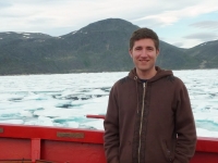
Ian’s career has taken him all over the world. Here he is in the Arctic.
Who uses ocean maps?
Ocean mapping is a growing field with a bright future. The need to understand the ocean floor has never been greater. We’re starting to understand the importance of the ocean environment to our world here on land, and we use ocean mapping in lots of ways. These include resource development (for example, oil and gas exploration and tidal power generation), habitat mapping (such as where scallops and lobster like to live), environmental protection, ocean circulation, global warming, and geology. With over 70% of our oceans left to explore, and technology always evolving, there will be a need for ocean mapping specialists for a long time.
Any advice for people wanting to work in this field?
I’d advise people looking to get into this field to take courses in math and physics in high school. Then enrol in a university undergraduate degree or college program that specializes in ocean mapping. Around the Bay of Fundy, these include the Geodesy and Geomatics Engineering program at UNB, or the Centre of Geographic Sciences courses at NSCC (Nova Scotia Community College).
What inspired you to work in marine science?
I was inspired to work in this field by my interest in exploration and maps, and my love of the oceans and coasts. I also really enjoy working with technology.


